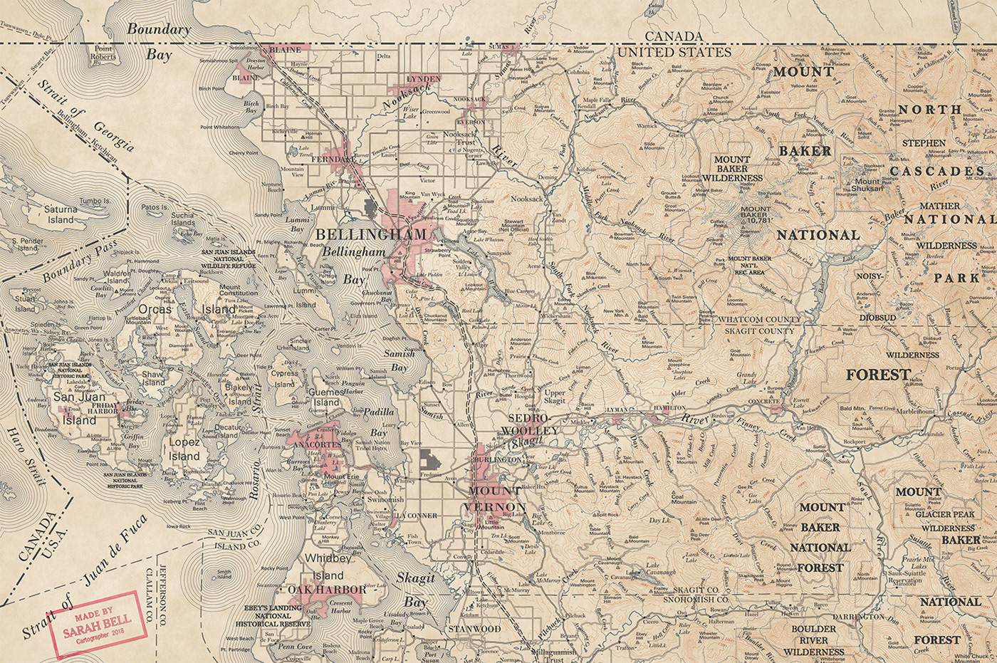
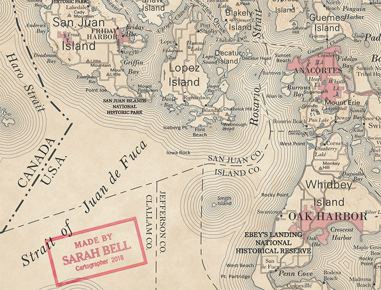
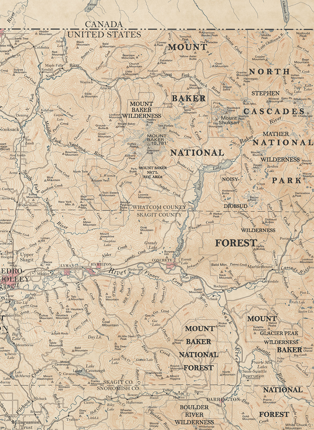
Making this map was a joy. It is one of a series of nine maps of the same extent, all with different design. I was inspired by the USGS antique topo styles. Some fonts are pretty close to what the U.S.G.S. used on their late 1800s - early 1900s topos. I'm committed to creating one of the fonts that occurs on that period of maps, but of which I had a hard time finding.
Look for that font now at sarahbellmaps.com
![cartography map Victorian antique GIS topo ILLUSTRATION seattle mountain diagram](https://mir-s3-cdn-cf.behance.net/project_modules/1400/17678369607587.5b870f5c578c9.jpg)
![cartography map Victorian antique GIS topo ILLUSTRATION seattle mountain diagram](https://mir-s3-cdn-cf.behance.net/project_modules/max_1200/c6dfc069607587.5b870f5c57302.jpg)
![cartography map Victorian antique GIS topo ILLUSTRATION seattle mountain diagram](https://mir-s3-cdn-cf.behance.net/project_modules/max_1200/4a314969607587.5b870f5c57e5e.jpg)
![cartography map Victorian antique GIS topo ILLUSTRATION seattle mountain diagram](https://mir-s3-cdn-cf.behance.net/project_modules/max_1200/3b20bc69607587.5b870f5c588a3.jpg)
![cartography map Victorian antique GIS topo ILLUSTRATION seattle mountain diagram](https://mir-s3-cdn-cf.behance.net/project_modules/max_1200/c470a569607587.5b870f5c58383.jpg)