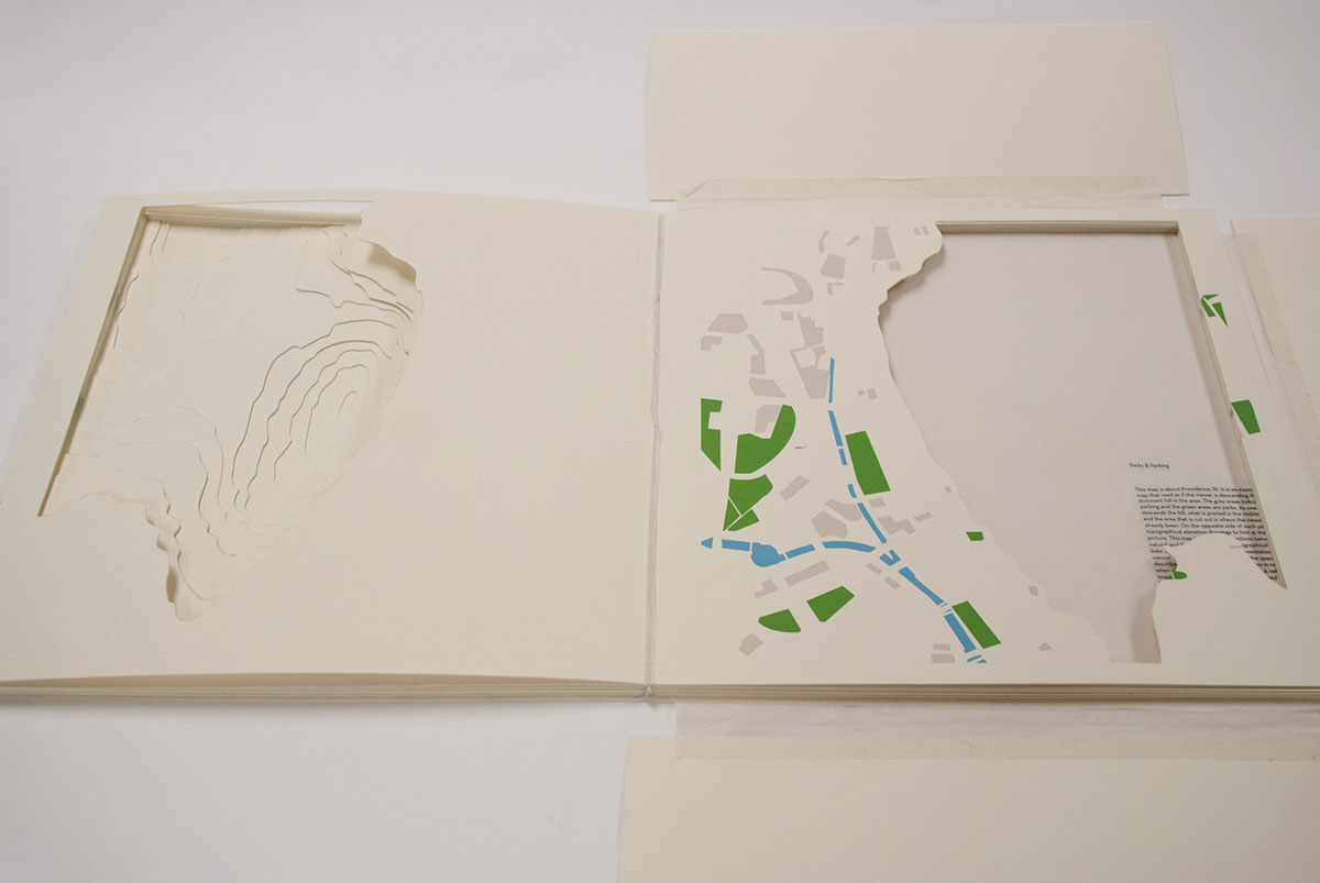
A 3 dimensional map that looks at Providence,RI.
Blue = canal
Green = park space
Gray = parking space
On the back of every page is drawn the topographic lines of Providence, and each page has one more topographic layer cut out prominent hill. The goal was to simulate walking down the prominent hill in Providence without actual movement. The lower down the hill you, and farther along in the book are the more of the map is removed.
This book is handmade and utilizes inkjet printing, laser printing, museum board, white vellum and rice paper. Each page is hand cut from museum board.
This book is handmade and utilizes inkjet printing, laser printing, museum board, white vellum and rice paper. Each page is hand cut from museum board.