


Illustrated map, infographic map, map illustration, travel map, africa map, adventure, website map. See more like this... www.paulweston.info
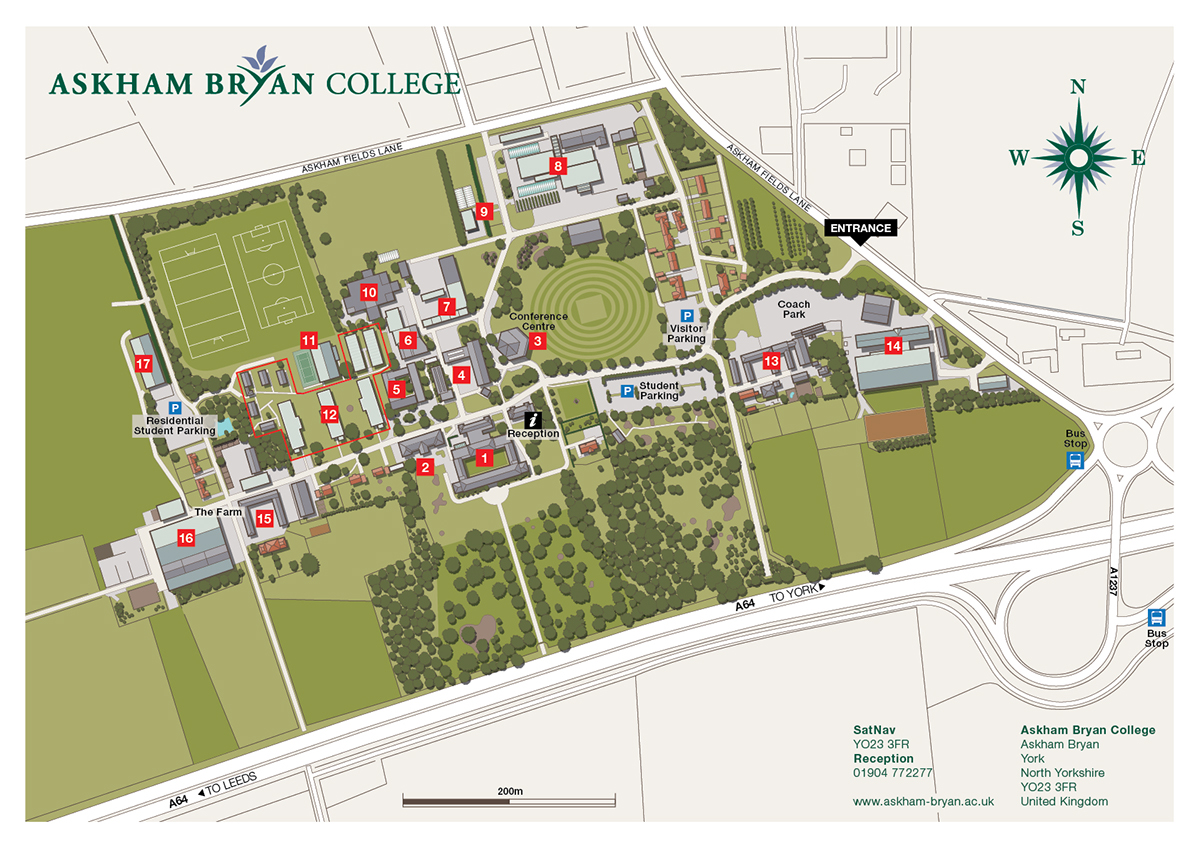
Illustrated map, campus map, university map, college map, prospectus map, map illustration, map infographic, wayfinding map, campus plan, college plan, university plan, prospectus plan. See more like this... www.paulweston.info

Illustrated map, route map, creative concept map, illustration, infographic. See more like this... www.paulweston.info

Software map, software mapping, software visualisation, infographic. See more like this... www.paulweston.info

Illustrated map, creative concept map, illustration, infographic. See more like this... www.paulweston.info

Knowledge network, map illustration, information map, infographic. See more like this... www.paulweston.info

Software map, software mapping, software visualisation, infographic. See more like this... www.paulweston.info

Network diagram, energy network, sustainable energy network, energy map. See more like this... www.paulweston.info

Illustrated map, technical infographic, flood protection schematic, infographic. See more like this... www.paulweston.info

3D map, 3D city map, illustrated map, infographic. See more like this... www.paulweston.info

Way finding map, map, floor by floor, exploded view, visitor attraction map. See more... www.paulweston.info


