
Formerly part of the I-195 corridor, the swath of land separating Providence’s Jewelry District from the Down City neighborhood was left largely undeveloped when the highway was rerouted in 2008. Within the last few years, the city of Providence has made a major push to develop the area by making it a hub for technology, research and design. Sitting along the banks of the Providence River, the southernmost parcel was set aside to become urban green space and will host a new pedestrian footbridge linking the east and west banks of the river.
From early on in the planning process, guiding pedestrians through the site and framing views became a main theme and goal of the design. Through rigorous site analysis and diagramming, I explored ways in which to achieve this goal by utilizing architectural elements, vegetation, and landscape engineering. Many of these strategies would carry through to the final design.


Diagramming how to frame views and guide pedestrians in landscape architecture


Initial plan sketches play with the idea of visual corridors, existing conditions and grid overlay.
In addition to designing a public space that could respond to the proposed urban development, the project put special emphasis on ecological and habitat restoration for endemic avian and aquatic species. Working with the Little Brown Bat and the Blue Mussel, the design process was driven by accommodating habitat for these species as well as creating a dynamic interface between the built world and the biotic.


Species boards detailing range, life cycle, feeding habits and habitat needs of the Blue Mussel and Little Brown Bat.
Drawing from different view framing techniques, the habitats for the mussels and bats were developed as mirror images of one another--one carving into the land and providing access to the river, the other rising from ground-level and becoming an overlook.

Early isometric diagrams of bat and mussel habitats and human interactions. Also features tidal fluctuations of the Providence river.
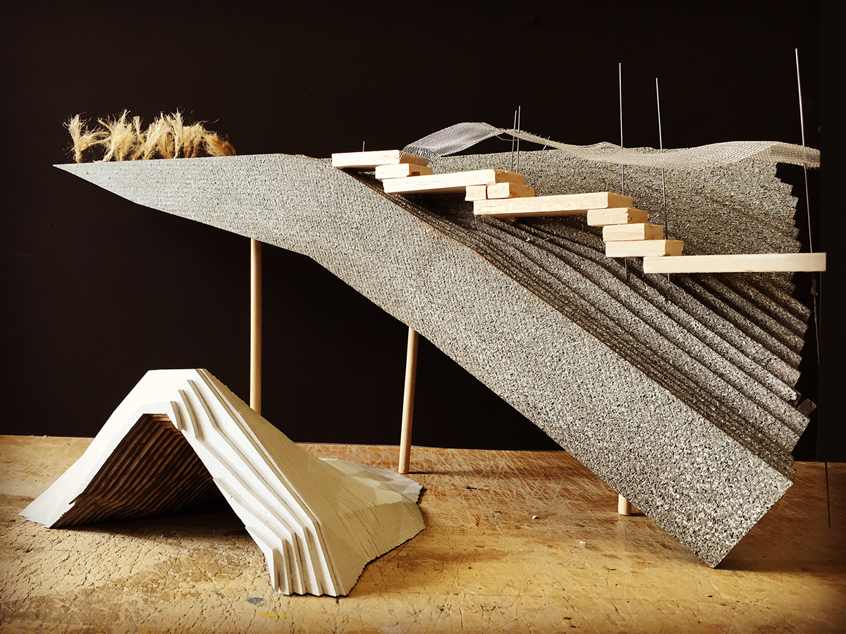
Habitat model for the Little Brown Bat (left) and sectional model of mussel habitat and river access (right).


Various process sketches and study models exploring site characteristics, scale, and habitat design.
The final design plays on the idea of “revealing the unseen” by using paths and topography to frame views, encourage exploration, and highlight the dynamism of nature. The topography channels storm water to a central depression in the site, creating an ephemeral pond below a small footbridge. A small cove is carved out of the land, mixing hard and soft edge conditions, providing two substrate types for the Blue Mussel habitat, as well as allowing visitors to access and experience the river directly. The highest point in the park, the southeast tip, offers views spanning the Providence river and out towards Narragansett Bay. Underneath the overlook resides the bat habitat with the notion that at dusk, onlookers can experience vast swarms of bats emerging from their roosts as the sun sets in the distance.

Final site plan including planned pedestrian bridge and existing and proposed buildings.


Site model and detail model of river overlook and bat habitat.

Planting palette including native plant species.

Rendered section of mussel habitat and cove overlook. Features soft and hard edge conditions of the river.

Section of proposed retail space for future building and patio which serves as a seating area for visitors and threshold leading into the park.
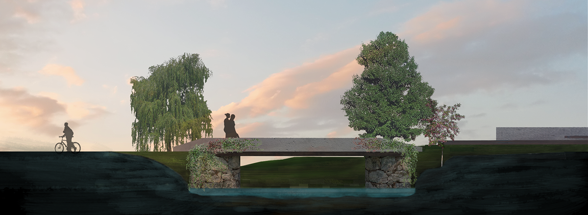
Sectional rendering of footbridge spanning the ephemeral pond in the middle of the park.

Rendering of main overlook at dusk. Lighted walkways help guide visitors to the elevated platform where bat viewing takes place.