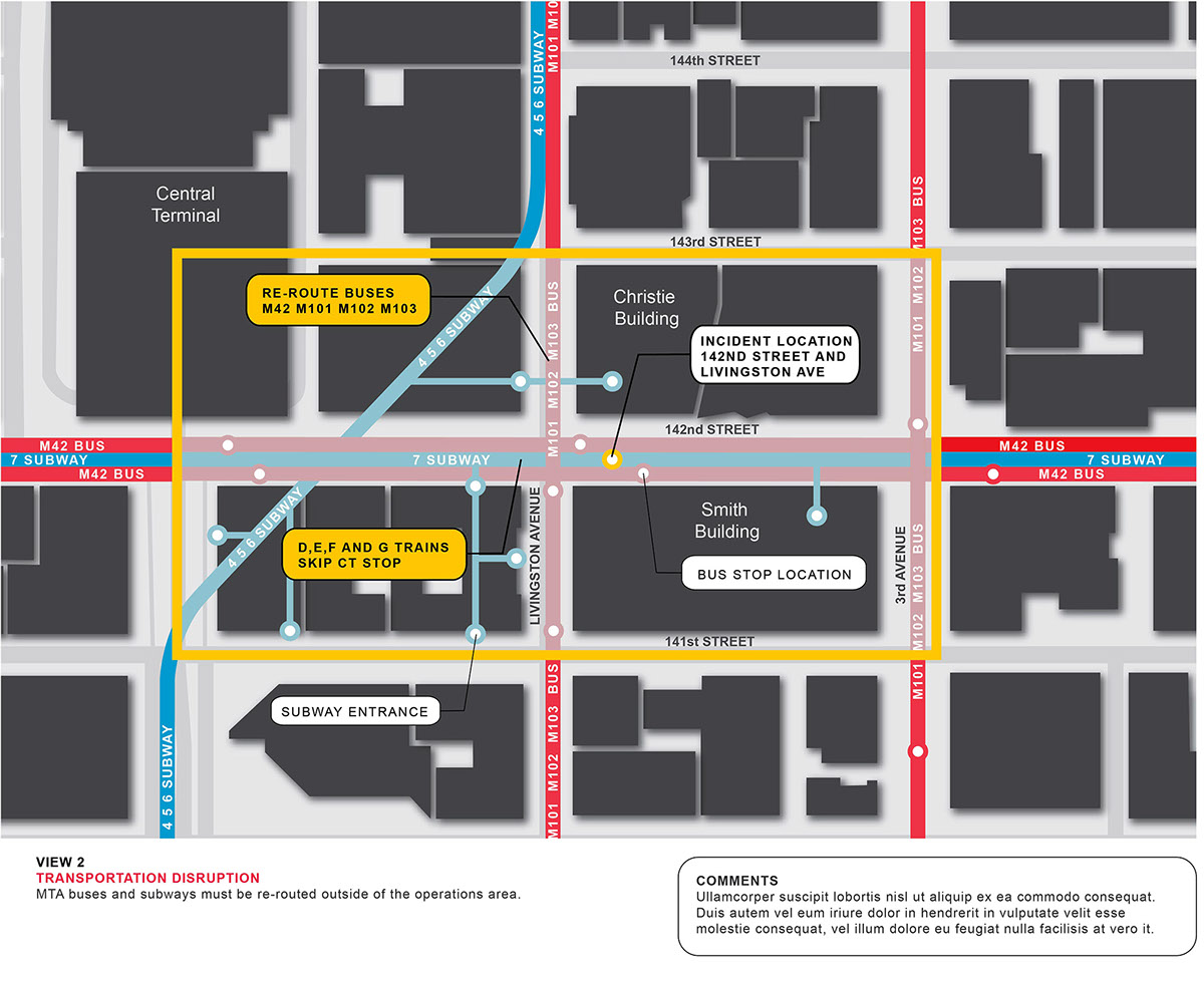
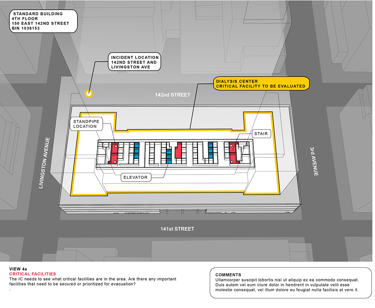
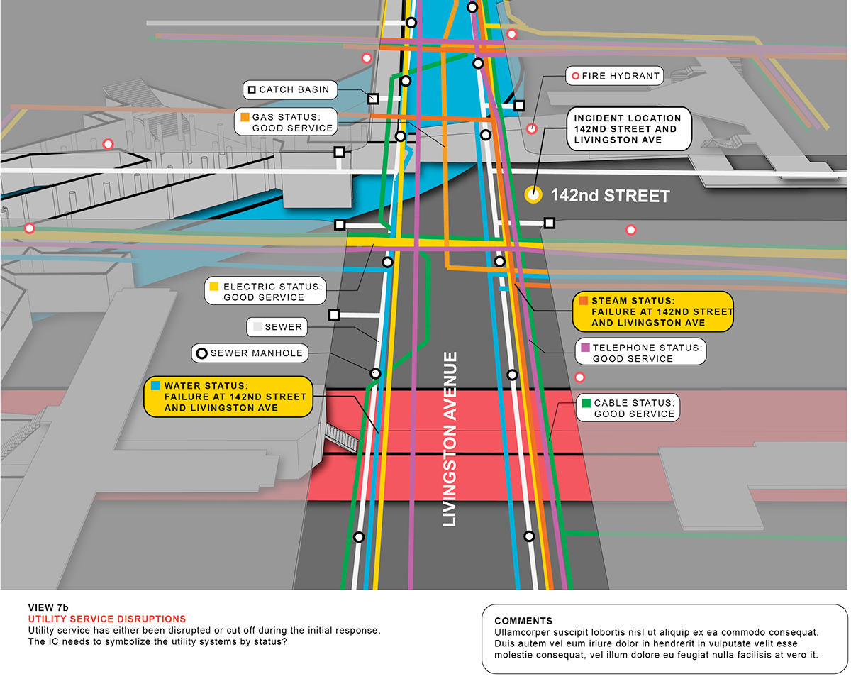
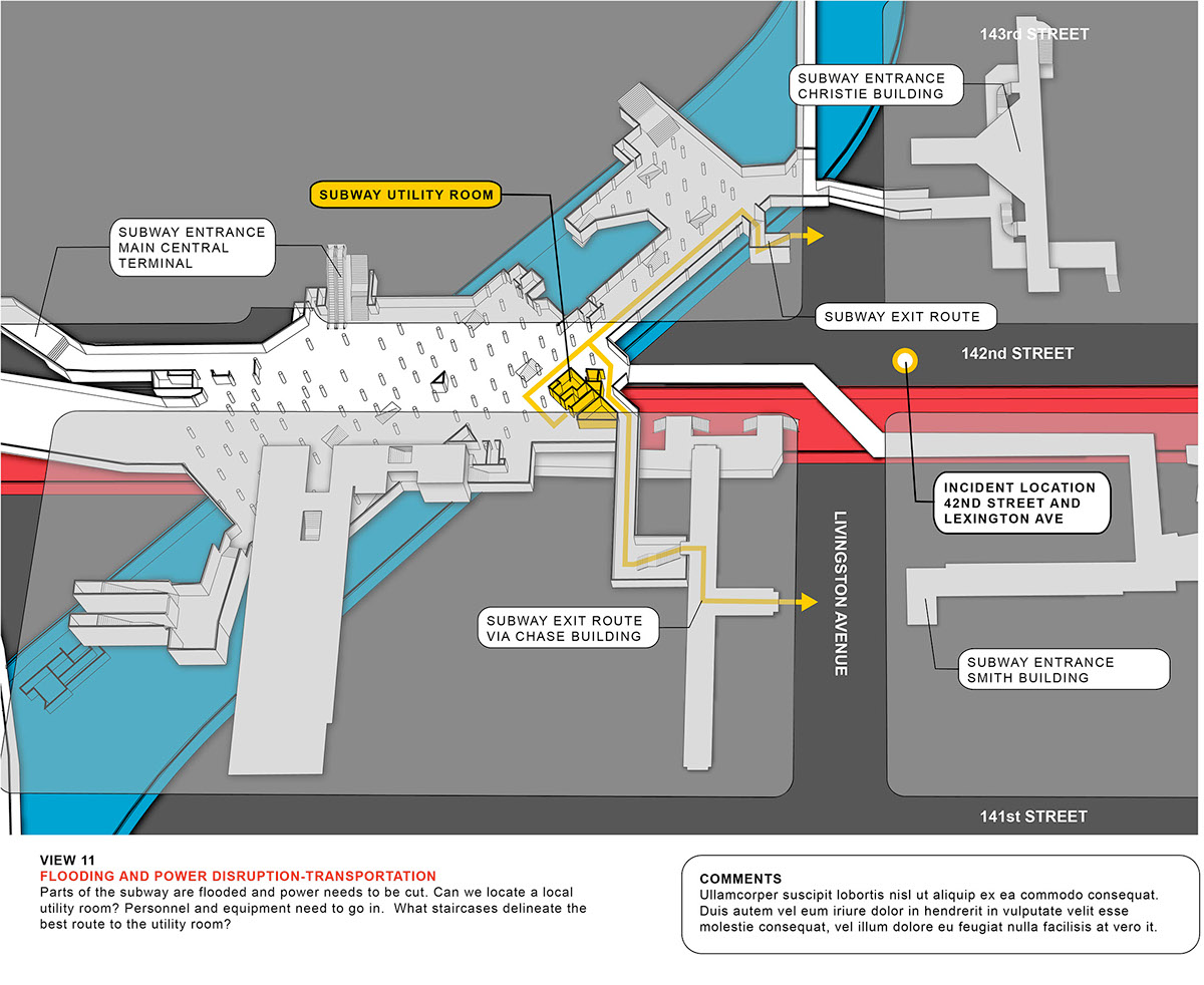
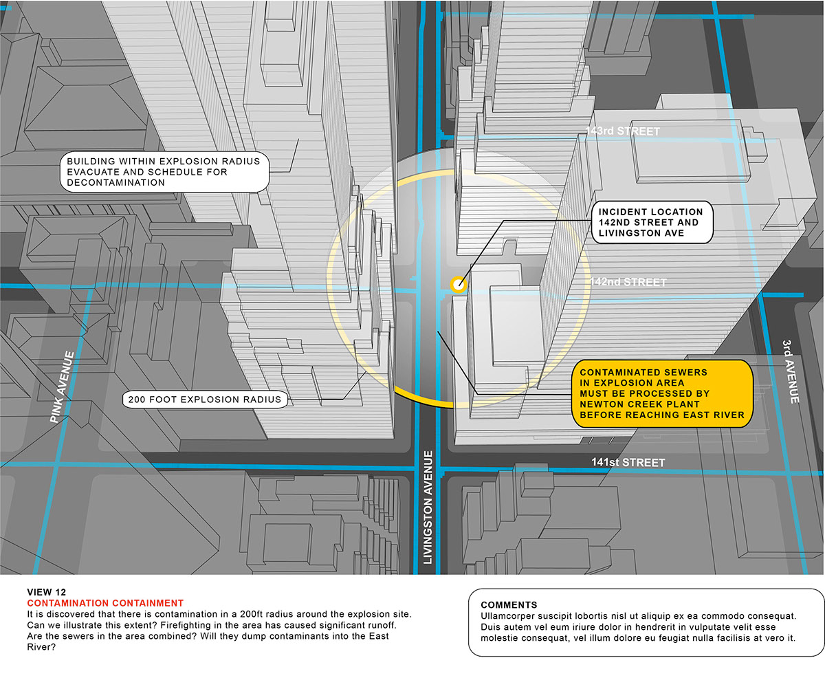
As part of C&G Partners' ongoing work with New York City’s Office of Emergency Management (NYC OEM), we collaborated with their planning team to develop graphic guidelines for a dynamic mapping initiative. The visualizations shown here help establish standards for plan, isometric and perspective views, and color coding and messaging (both above and below ground). One important note for those reading the fine print: these examples are based on a fictional citywide emergency – this is not a real disaster – and similarly fictitious data has been used throughout the renderings.